Dolpo via Dhorpatan Trek
Overview
Dolpo via Dhorpatan trek and Dhorpatan Hunting Reserve and Shey Phoksundo National Park lie in rain shadow of the Himalayas in the central North West of Nepal. These two remote areas hide vast wilderness rich in flora and fauna, sparsely populated and extremely beautiful, making for the best trekking in Nepal. This trek cover many passes, jungle ravines and over the Himalayan main chain.
Dhorpatan is located on the southern slopes of Mount Dhaulagiri in the Baglung District of the Mid-Western Region of Nepal, the small village of Dhorpatan is best known for being the headquarters of the Dhorpatan Hunting Reserve – a sanctuary for animals where a limited amount of hunting is permitted. The area covering 1325 sq. km., the reserve is situated on the southern flanks of Mt. Dhaulangiri I (8167m.) in districts of Rukum, Baglung & Myagdi in western Nepal.
This trek we start from Beni, after day drive from Kathmandu or Pokhara going through nice village in the beginning and through high and remote area and passes later and finally come down to Jhupal where we catch flight to Kathmandu. The route goes through high passes and very remote area of the country so we are rewarded with excellent view of mountain and virgin Tibetan culture on the way. This is beautiful trek over many passes, jungle ravines and over the Himalayan main chain. Trekking from Beni to Dolpo is counted as a difficult level of trekking from the point of view of accessible. The main attraction of Beni to Dolpo region is the landscape, people, wilderness region and the famous Phoksumdo Lake. As this is Nepal's one of the most demanding trek and goes through Numala & Bagala pass and remote area of the country where we should make lot of ascend and descend we therefore recommend to attempt only for experience trekkers.
Highlights
- Rim of the Kathmandu valley excursion
- Scenic drive to Beni via Lake valley of Pokhara
- Visit Dhorpatan Hunting reserve
- Challenging special trek observe the remoteness of Nepal
- Ancient trans-Himalayan caravan route and isolated villages
- Spectacular Lakes
- Enthralling Tibetan culture and tradition
- Earliest Bon-Po culture
- Buddhist Monastery and Tibetan life-style
- Seeing the people and settlement among highest in the world
Trip Summary
| Trip Grade | Moderate to strenuous trail. |
|---|---|
| Trip Duration | 31 Nights/32 Days |
| Trip code | NAP-LDOL-412 |
| Trip Start/Ends | Kathmandu, Beni/Nepalgunj, Kathmandu |
| Maximum Altitude | Numa-La Pass (5238m), Baga-La pass (5214m) |
| Trip Cost | Prices on request |
| Group Size | Minimum 2 upto 16 persons in one group |
| Accessibillity | 8-hrs drive to Beni via Pokhara and fly Jhupal/Nepalgunj to Kathmandu |
| The Route | Maximum altitude upto Numa-La Pass (5238m), Baga-La pass (5214m), 5/7-hrs average walking per day, Moderate to Strenuous trail. |
| Season | Aug-Nov and Mar-May |
| Permit Fee | Per week per person US$ 10 or equivalent convertible foreign currency. |
| Trip Facilities | 3+ hotel in city on B/B and home-stay/camping on mountain |
Itinerary

Upon arrival at Tribhuwan international airport, welcomed by our representative and transfer to hotel. The remainder of the afternoon is at leisure. A pre-trek briefing will be given in the evening at hotel about the daily program activities by your Group Leader/Guide.
After breakfast the day will start with a guided tour of Kathmandu's historical and spiritual key attractions; including the historic Kathmndu Durbar Square, the famous 'Monkey Temple' (Swayambunath) and then finally visit to Patan Durbar square which is situated the heart of the city constitutes the focus of visitor's attraction. In the evening there will be pre-trip discussion where you can meet your group leader/guide then you can ask any questions you may have.
This day after breakfast being early in the morning before 7:00 AM. This morning you will be drive to Pokhara (200km), departure at 7:00 AM in the morning, approximately 6/7 hrs away by tourist bus. You will be arriving late afternoon at Pokhara approximately 2:00 O’clock. The drive from Pokhara goes through uphill into zigzag road all the way to Naudanda. It then descends through zigzag road up to Nayapul with views of Annapurna South, Fish tail, green hills, terraces and villages. To reach Beni, your drive moves along the bank of Mardi River. This is one of the picturesque road journeys.
To reach Singa Bazaar you have to follow past the hot spring along the bank of Beni River with views of villages at some distance. Singa Bazaar is a village with tea shops, lodges, hotels, beautiful terraces and typical houses. There is a small market which provides minimal supplies. Leaving Singa Bazaar, you move through quite flat land all the way to Tara Khet passing through villages. On the way, you can see mules carrying loads. Tara Khet is another village and it is famous for Marijuana.
This day you trek through gentle ascent path until you reach Panchey (1700m.) passing villages, few trees and green hills. Now crossing a suspension bridge over Beni River you arrive at Tokra (1820m), a village. Descending gently for couple of minutes, you reach Junla (2020m.), mostly considered as a pass. The trail appears to be quite flat passing through villages, sparse forests and green hills and you reach Danyga Khola. Danyga village lies at the bank of Danyga Khola. There are few typical houses and you can see local people, who mostly belong to Magar community, are involved in farming.
The trail is ascent and descent as well at the beginning and later moves through flat land all the way to Dharapani. En-route you can enjoy the spectacular views of green hills, forests, typical houses and mountain views of Dhaulagiri, Mana Pathi Himal and other unnamed mountains. Dharpani is a village with good infrastructure. There is a tap (dhara) at Dharapani and village is named after this. Local people of this area belong to Magar, Chhetri and few other communities.
At first you trek through gentle flat land with green hills on both sides. After some distance, the path goes quite up for a long distance passing through villages, forests covered with pine, oak, rhododendron and local vegetation. Before you enter Muna, you have to trek through flat for couple of hours. Muna is a big village with good infrastructure. Mostly people here are devotee of Hindu God and Goddess.
To reach Lumsum you have to trek through steep ascent path passing through the oak and rhododendron forests with views of Dhaulagiri, Mana Pathi and few other unnamed mountains. The path is steep up until you reach Jaljala-La passing through Moreni, a village where people follow Tibetan life style. Jaljala is alpine grass land atop a ridge where people of surrounding villages bring their domestic animals such as yak, sheep for grazing. This is best described as hunting area. From the top you are speechless to see at the panoramic views of Dhaulagiri range.
The trails until Gurjakot are steep descent and then it moves through flat land all the way to Dhorpatan. You walk along the bank of river passing through forests covered with oak, pine, rhododendron, juniper and other local vegetation. Gurjakot is a small village mostly dominated by people who follow Tibetan culture. There are Chortens, Mani walls and prayer flags fluttering in the bridge. On the other hand, Dhorpatan is a point where roads from Baglung, Beni, Rolpa and Rukum meet. There is small airport. You can see apple orchard and wheat, buck wheat, maize and mostly potatoes growing in terraces. One of the most significant features about this place is that anyone can go for hunting by paying certain fees to the Government authority. As Dhorpatan is the only area for hunting in Nepal.
You can visit Monastery, Chortens and local markets. Hiking green hill will give you another pleasure. The typical houses with wooden roofs attract you. You can learn about the social and cultural life style of local inhabitants.
Leaving Dhorpatan you head uphill up to Phagune Dhuri Pass passing grass land and sparse forests. This pass is surrounded by green hills and you can see villages at some distance from the top. Now the trail goes steep down passing villages, terraces and a suspension bridge over Pelma Khola. As you cross bridge you begin to follow gentle ascent path through terraces and local villages all the way to Takur. This is a small village where you find local people being involved in their daily activities.
The supposed trail moves down all the way to Pelma crossing a wooden bridge over Pelma Khola. On the way, you can see several villages, terraces, green hills and local people. Pelma is a village and people living in and around this area are not well to do. As you can see not well managed houses and people being involved in farming.
Crossing Pelma Khola the trails go steep up all the way to Dhule. En-route, you pass through picturesque villages, terraces and green hills. Dhule is yet another village at a certain height.
The beginning part of the trail moves through the pine, rhododendron, and juniper forests along the steep ascent path until you reach Nautale Bhanjyang. You can enjoy the panoramic views of Dhaulagiri range and other unnamed mountains. Nautale Bhanjyang, atop a ridge is a grass land where local people bring yak and sheep for grazing. To reach Seng Khola you trek through gently ascent for couple of hours and the trail turns steep up all the way to your destination. Seng Khola is a village which lies at the bank of Seng River. You can see terraces with wheat, buck wheat and mainly potatoes growing in it.
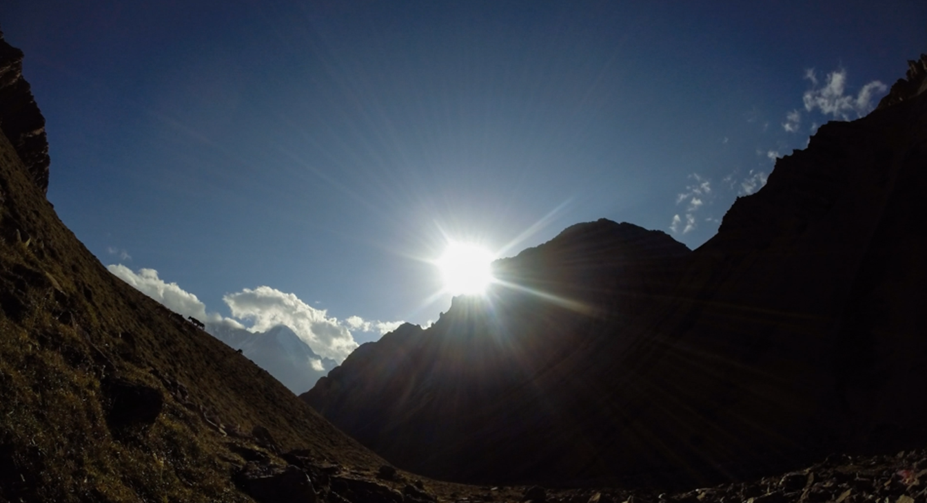
You trek steep ascend all the way to Purpang following rocky and dry land. En-route you come across alpine grass land. From Panidal Pass you can have panoramic views of Dhaulagiri range, Kantagaton Himal, Nurbukang Himal and other unnamed mountains. While heading towards Purpang, you cross rocky and slippery trail. Purpang is an open rocky grass land surrounded by spectacular mountains.
The trail you follow is steep ascent up to Jangla Bhanjyang passing through rocky trails. You are accompanied by panoramic views of Norbu Himal, Kantagaton, Dhaulagiri, Serkeam Himal and few others. After you Jangla Bhanjyang, you are quite surrounded by above mentioned mountain views. Crossing Jangla Bhanjyang, you begin to follow gentle descent path all the way to Tokar. It is a small village surrounded by hills. To reach Tarasahar, you again follow steep descent path passing through few villages and sparse vegetation. Tarasahar Tara is yet another village with terraces which lacks necessary infrastructure and far from modernization.
Crossing several villages you walk downhill all the way to your destination. Tarakot is a small village which falls en route. Yalkot Khola is also a village which lies at the bank of Barbung Khola. The camping spot Kanigaon is yet another small village where you find a small market with shops, tea houses and lodges.
After breakfast we continuous our walking to follow the Tarap Chu River upstream, crossing by bridge and crossing the same river twice. The path leads through the farm terraces and rural villages. From this place descend to Khanigaon then we continue walking up to the gorge of the Tarap River, rising high above on a trail built out from steep slopes. The walk is quite exciting as the valley becomes narrow gorge that in some places you can jump from one side to another.
After breakfast we start our treks with a pleasant walk and with most scenic landscapes and easily get to the Yak Kharka. We will have lunch at the middle of the way. Camp will set up as before and we overnight at tented camp at Langa.
This day is the pleasant day free from the hassle. Tarap is a traditional agricultural village, surrounded by fields. Yaks are used to plough the land. As in the other villages you came across, barley, buckwheat and potatoes are among the few crops that can grow here. But nowadays, small greenhouses enable the people to grow some green vegetables as well. Besides, people live from what the yak gives them and from trade. The houses are made of stones found in the river valley and are in typical Tibetan style, with small windows and the flat roofs stocked with firewood.
Close to Dho are 2 monasteries which are worth a visit. Ribo Bhumpa Gompa, right on the hill behind Dho, and Shipchaur Gompa, which is in the village Shipchok, 30 minutes walking from Dho. Ribo Bhumpa Gompa belongs to Nyingmapa Buddhism, by the local people called Chöba Buddhism. Inside you find a beautiful big statue of Guru Rinpoche. Guru Rinpoche (Padmasambhava) is a very important Buddhist saint from the 7th century AD. He conquered the demons that were preventing Buddhism to get hold in Tibet and in this way made sure that Buddhism could be introduced in Tibet. You can easily recognize him, by his big eyes, little mustache and the staff with skulls he holds. Next to the Gompa is a chorten with a chorten inside, which is said to hold the remains of a demon killed by Guru Rinpoche. Shipchaur Gompa in Shipchok belongs to Bonpo Buddhism.
This day is the pleasant day free from the hassle. Tarap is a traditional agricultural village, surrounded by fields. Yaks are used to plough the land. As in the other villages you came across, barley, buckwheat and potatoes are among the few crops that can grow here. But nowadays, small greenhouses enable the people to grow some green vegetables as well. Besides, pe
After a wonderful time here at Dho Tarap, our journey continues towards upper Tarap valley, the walk follows in this plain valley with patched of lush verdant grass on both sides of the river, which is completely different from other parts of inner Dolpo. The trek on this pleasant track leads by the Tarap Chu upstream all the way. Tarap is certainly a dream valley with vast plains in high mountains extending twenty kilo meters along the river Tarap Chu, having ten villages with cultivated fields of barley, buck wheat, wheat and potato. After 3-4 hrs of good walk in this perfect tranquility coming to the village of Tokyu. Tokyu is said to be the highest permanent settlement in the world. The Gompa is worth a visit. It has a beautiful statue of Maitreya, the Future Buddha.
This day is a tough day when the pass is covered with snow, but it is not really difficult when the route is clear. It takes about 3 hrs to reach the Baga-La pass (5190m) marked by prayer flags and cairns. From the pass one can see several snow clad peaks including the Kanjiroba massif. After a glorious moment at the pass, almost three hours of downhill walk takes to the Baga-La Phedi for overnight halt.
The trail this day remains on the right bank of the Sanu Bheri. It is a magnificent trek with wonderful views every step of the way. In some places there are broad meadows and in others the valley teeters along steep hillside. Along the trail we will see Norbu Kang (6005m), Kagmara peak and other peaks of Kanjelaruwa. Eventually the trail emerges onto an area with thorny shrubs and descends a bit, then climbs on a high Cliffside trail to a ridge at 3780 meter. From here is a great view across the valley to the huge waterfall formed by the Phoksumdo Khola River. The trail levels out again and re-enters the forest as it climbs to another ridge at 3820 meter. It descends gently through a blue pine forest to the national park camping ground near Phoksumdo Lake. It’s a spectacular lake of 4.8 km long and 1.8 km wide. It is said to be 650 meter deep. There is no aquatic life in the lake, which helps to make the water brilliantly clear and it has an aquamarine like colour. Ringmo is a charming village. People practice the Bonpo religion here. Bonpo is a lot older than Buddhism and goes thousands of years back. It has more animistic aspects than Buddhism. For outsiders it is difficult to see the difference between Bonpo and Buddhism, but one important aspect is that you have to cross their Mani walls and chortens anti-clockwise, while according to Buddhist custom, you pass them clockwise. The women wear dark or checked dresses with colorful aprons made from yak wool. You see fewer men in the typical dress, which is a long coat, from which they let one sleeve hanging down. Strolling around the village, you might see women weaving. In Ringmo women make very nice woven products, like belts, bags, shawls and blankets. Most items are made from cotton, but they also sell products made from yak wool. There are a few shops where you can buy this iteams.
The Phoksundo Lake is such a beautiful place for a free day. There is a beautiful Bonpo Gompa (Monastery) at the shore of the lake, which is worth a visit. It’s a 20 minute walk to the monastery through the pine forest. In the monastery you can observe a statue of Thönpa Chenrab, the founder of Bonpo religion, a Buddha who lived thousands of years ago.
The Phoksundo Lake is such a beautiful place for a free day. There is a beautiful Bonpo Gompa (Monastery) at the shore of the lake, which is worth a visit. It’s a 20 minute walk to the monastery through the pine forest. In the monastery you can observe a statue of Thönpa Chenrab, the founder of Bonpo religion, a Buddha who lived thousands of years ago.
Following the trail gently sloping upwards, we march towards Jhupal. We meet tall birch trees on our way. From atop the ridge, we can have the most spectacular views of the mountain and Jhupal below. Utmost caution is required while trekking along this trail. After reaching Jhupal, we can spend our afternoon exploring the busy market town or simply pursuing whatever we feel like.
Early morning, a short scenic flight for thirty five minutes to Nepalgunj, over the Himalayan foothills overlooking stunning views of the main peaks including Annapurna and Dhaulagiri to the north. On arrival at Nepalgunj depending upon the connecting flight schedule to Kathmandu. If it is in the afternoon have time for few hours’ refreshment in the comfort of the Hotel Batika or similar at Nepalgunj. Then connect with the flight back to Kathmandu.
This pleasant day you may have full day at leisure and either relax at hotel or explore the Thamel and overnight at hotel.
After breakfast you will have some free time until the time to leave the international airport for your final departure.
Cost Included
- Document: Dhorlpatan Hunting reserve permit and Lower Dolpo permit, National park Entrance permit and TIMS card.
- Equipment: Two men sleepiing tent, Necessary Dining, Kitchen, Toilet tents and Mattresses, Table, chairs, kitchen utilize.etc.
- Accommodation: 4 nights hotel in Kathmandu on twin sharing bedroom 26 nights at tented accommodation on mountain.
- Food: Full board on Camping (Breakfast, lunch and dinner) during the trekking period and 4 breakfast in city.
- Staffs: Leader/Guide and supporters and their daily wage, food, and accommodation
- Transportation: All airport arrival/departure transfer and surface road-head transportation and Jhupal to Kathmandu via Nepalgunj flight
- Company and Government’s service charge: All applicable Government taxes, official service charges.
- And Crew’s insurance, daily wages/salary, food, equipment and flight and road transportation
Cost Excluded
- Your international flight
- Travel/medical insurance coverage personal accidents, medical and emergency Helicopter rescue
- Personal travel and trekking equipments
- Lunch and dinner while in city
- Items of a personal nature such as normal drinks, hot shower, dessert, laundry, internet and phone call.
- Tips/Gratuities for your trekking crews
- Temple and Monastery entrance fees
- Optional activities
- And unforeseen expenses which are out of control by Nepal Adventure Point
Trip Notes
Please request our Trip Note advice and detailed itinerary.