Nyinba Valley Trek
Overview
Nyinba Valle trek is one of the most remote districts in Nepal, Humla is the gateway to Manasarovar and Mount Kailash in Tibet. Humla district far from modernization is still unaffected from the adverse effect of tourism and remains isolated in the midst of mountains and rocky terrain. In this isolated Himalayan high altitude region lays the beautiful the Nyinba Valley. While you enter Nyinba valley it seems as if you have time travelled and went back to the 18th century. This old Tibetan village has well preserved the Buddhist traditions which are older than anyone can imagine but are still an important part of daily life. Nyinba Valle trek brings you to the Buddhist monastery of Raling Gompa, which is spectacularly located at the bottom of Crystal Mountain.
Highlights
* Rim of the Kathmandu city excursion
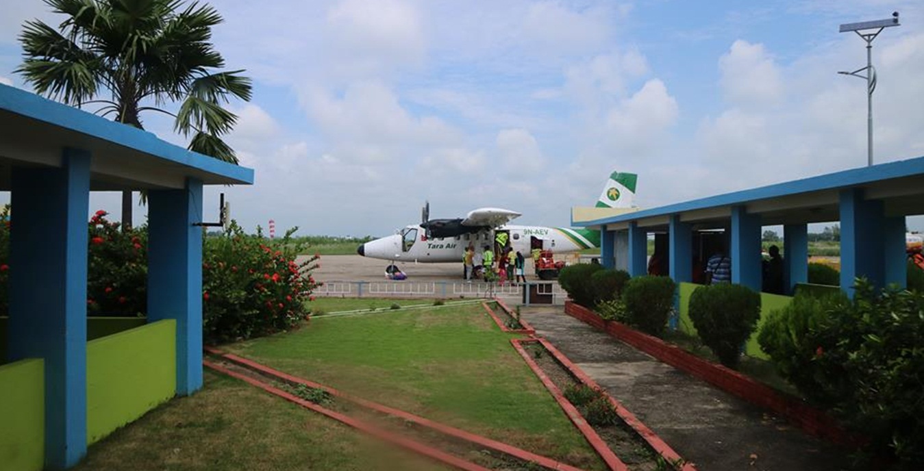
* Scenic scheduled flight to Nepalgunj and Simikot from Kathmandu
* Trekking to between Nepal and Tibet part
* Buddhism and Bonpo Tibetan culture
* Tibetan people of diverse groups and cultures
* Gateway to Manasarovar and Mount Kailash
* Rare flora and fauna
Trip Summary
| Trip Grade | Easy and moderate trail, |
|---|---|
| Trip Duration | 11 nights/12 days |
| Trip code | NAP-HMS – 506A |
| Trip Start/Ends | Nepalgunj-Simikot/Lhasa-Kathmandu |
| Maximum Altitude | Raling Gompa (3930m) |
| Trip Cost | Prices on request |
| Group Size | Minimum 2 upto 16 persons in one group |
| Accessibillity | Fly to Nepalgunj and Simikot, start the trek according to the itinerary, after trip fly back to Kathmandu. |
| The Route | Reach upto Nepal/Tibet boarder 5/7-hrs average walking per day, moderate to strenuous trail. |
| Season | Sept – Nov / March - April |
| Permit Fee | For the first 7 days per person US$ 50 and After 7 days per day per person US$ 7, or equivalent convertible foreign currency. |
| Trip Facilities | 3+ hotel in city on B/B, home-stay/lodges accommodation on mountain. |
Itinerary

To get to Humla, you have to fly to Nepalgunj first. Nepalgunj is a steaming hot city in South Western Nepal, in the lowlands of Terai, close to the Indian border, which is just 8 km away. Culturally the area more resembles India than upland Nepal. Take a cycle rikshaw for a ride in town. You pass the hustle and bustle of the bazaar and see horse carts full of colourful people going to or coming from the Indian border. The Bageshowri temple is one of Nepal’s most important Hindu temples and is worth a visit as well
It’s a 50 minutes flight to Simikot over steep mountain ridges with beautiful views of snow-capped mountains, among which Mount Saipal (7030 m). Simikot airport is a blacktopped airstrip amidst the mountains, which guarantees a spectacular landing.Stepping out of the plane, you enter in a completely different world. From a hot city in the plains, you arrive in a small mountain village, situated in the midst of the Himalayas, breathing in crispy cold air.Simikot is the headquarters of Humla and has a mix of Hindu and Buddhist people.There is a small bazaar. Simikot has one hotel (Sun Valley Resort) and a couple of guesthouses and places to camp. From the airport you walk up through the village till you reach a water tap, which is usually quite busy with people washing or doing laundry. The trail going left is the trail leading to Hilsa at the border with Tibet. This trail is quite popular as a gateway to Mount Kailash. For the Nyinba Valley however, you head right. After about 1 ½ hour gradually climbing, you reach some prayer flags and a school. This place is called Limbuk (3227m).You leave the main trail, and go left under the prayer flags, on a small trail behind a little house. You walk on a small steep trail for a while, to the right of a fence. The trail flattens and goes through the fields at first and then along nicely smelling bushes of juniper. In front of you you can see the snowcapped mountain of Pungrikar (also called Panchauli;around 6000 m) and Cristal Peak; and behind you the Ribuche range (only snow in winter and spring). It takes about 1 to 1½ hour to Buraunse Gompa, a home with a small monastery (gompa) inside, where the priest of Buraunse lives. From here it is about 45 minutes down to Buraunse.Buraunse is a small Tibetan Buddhist village, surrounded by fields with barley and millet.The hauses are in typical Tibetan-Buddhist style, with flat roofs. There are 5 homestays in Buraunse; each of which has 1 or 2 rooms for guests. It is a great experience to stay in a homestay, as it offers you the opportunity to have direct contact with the local people and to learn a bit of how they live their daily lives. You have dinner with the family; all food is organic and quite tasty! You will be served delicious dal bath (rice with lentils), potato curry, tsampa (barley paste) buckwheat pancake, thukpa (soup with vegetables and thick wheat noodles), etc. Besides, you will be offered chang, a locally brewed beer, made of millet or barley. Be prepared for the refills, which can’t be refused!
You leave Buraunse going down to the Ghatte Khola (river), which you cross by awooden bridge. (3050m). The trail climbs gradually and you pass the village of Langdu (3172 m). It is easy walking through beautiful countryside, with terraced hills stretching out in front of you and at the horizon the snowcapped mountains of Changla Himal (6563m) and Cristal Mountain.Once and a while you pass a small Buddhist stupa or mani wall. A mani wall is a low wall with flat stones, with Buddhist mantra’s carved into them. The most famous mantra is “Om Mani Padme Hum”, which means roughly “Blessed is the jewel in the lotus”. This mantra honors Avalokiteswara, the Boddhisatva (an enlightened being that decides to come back to the earth to help others) of Compassion.
After about 2 hours you enter the village of Thorpa (3180 m) through a Kangni (gatestupa), with beautiful Buddhist paintings inside. The Kangni protects the village from bad spirits entering. Thorpa makes for a good lunch break.Shortly after Thorpa you pass a small site, called Bhibuck Cave (a meditation cave), with next to it a huge prayer wheel. Inside the wheel, the mantra “Om Mani Padme Hum” is written thousands of times, so turning the wheel will make the mantra go into the universe for thousands of times as well.You pass the village of Hutick (3242 m). From here it is more or less one hour gradual climbing to the village of Nimatang (3325 m), which has a Kangni (gate stupa) at its entrance as well. Nimatang is slightly bigger than Thorpa and Hutick and is the last village before Raling Gompa. There are a few homestays. You can also pitch your tent on the roof of one of the houses!
Today you leave the countryside behind. You walk through beautiful pine forests, with lovely smelling juniper trees and bushes. The trail goes down for about half an hour to the Ghatte Khola which you cross by an iron bridge (3215 m). From here the long climb to Raling Gompa starts. It is a beautiful, small trail, climbing up gradually through the forest. You have beautiful views of the entire Nyinba Valley, with to the southwest Ribuche Moutain, the Changla Range to the southeast and Pungrikar (Panchauli) Mountain to the north.A pole with prayer flags high above you is your aim. It takes about 1 ½ hours to the pole.This place is called Tokra (3547 m). Here most Nyinba people camp during the annual Saga Dawa Festival. The Saga Dawa festival is celebrated in Raling Gompa in May. It marks both the birthday, enlightenment and passing of Sakyamuni Buddha. During this festival lots of rituals, ceremonies, and mask dances take place. All people from the valley gather in their most beautiful dress to attend the ceremonies. The Saga Dawa Festival is one of the most important Buddhist festivals. The most important place for the festival is Mount Kailash, but the festival is also celebrated in Raling Gompa. It is believed that good deeds and prayers are multiplied thousand fold during this event, so many people will be immersed in prayers and trying to appease the gods.Going up slowly, it takes another 1 ½ to 2 hours to the campsite just below Raling Gompa (3930 m). From the campsite you can see Raling Gompa being stuck to the barren rock, with behind it the beautiful Cristal Mountain. A spectacular sight!It takes about 20 minutes from the campsite to Raling Gompa (4000 m). Raling Gompa belongs to the Nyingmapa Sect of Buddhism, the oldest Sect within Tibetan Buddhism.Followers honor Guru Rinpoche (also called Padmasambava), the famous Guru who introduced Vajrayana Buddhism to Tibet and neighboring countries in the 8th century.Follow the Tibetan tradition and walk a kora (circumambulation) around the monastery for 3 times, before entering. Next to the monastery you can find the famous Milarepa Cave, the cave where Milarepa used to meditate. Milarepa is one of Tibet’s most famous holy figures. He was a yogi and poet, and is generally pictured with a hand at his ear to hear the sounds of the nature, by which he got his inspiration. The story goes that Milarepa was being attacked by a demon, who threw a huge rock down at him. However,he used his extraordinary magical powers and the rock mysteriously molded around his body. In the cave you can witness the molded rock
Today you descend again, back to the iron bridge over the Ghatte Khola (about 2 hrs).You follow the river downstream. After about 15 min you pass a junction, the right trail up goes back to Nimatang. To Bargaun you take the left fork, going down. The trail goes high above the river again. It is easy walking through juniper bushes and fields. After about half an hour you pass the settlement of Nimatang Gomba (3185 m). Nimatang Gomba consists of just a couple of houses. Inside one of these houses is a small gompa (Buddhist monastery).The trail continues above the fields for a while, and goes high over a slope. It takes about 1 ½ hours to Bargaun (2940 m). Bargaun is a charming village surrounded by fields and has a few homestays. It is mostly Buddhist, but there are also Hindu people living in Bargaun. As with Nimatang you can also pitch your tent on the roof of one of the houses
After a nice and filling breakfast of buckwheat pancake and/or potato curry, you proceed again on a small trail going down through terraced fields. After about an hour you reach Tehe (2624 m), the biggest village of Humla, with about 600 seholds. Tehe is a Hindu village. The contrast with Bargaun, which is just an hour away, is quite stunning.Whereas Bargaun is relatively wealthy, the people in Tehe are one of the poorest in Humla. From Tehe there is a trail going straight down to Gyackru Khola (river) (1-1 ½ hrs).Reaching the river, you follow it downstream to Karpunath (2106 m) (1 hr). Karpunath is located at the confluence of the Gyackru Khola (here also called the Karpu Khola) and the Karnali Khola. In Nepal, a confluence of 2 rivers means a holy place, and there is a small, simple temple which you can visit.The location of the campsite is spectacular, next to the river with steep rocks towering high above you. Behind you can see Cristal Peak, the peak towering above Raling Gompa.
The trail of today is mostly going up. For the first 2 hours it climbs gradually, following the Karnali River upstream, to the small Hindu settlement of Syamne (2347 m). From Syamne the steep climb to Simikot starts with the trail climbing zig zag over a steep slope. When you get higher, you have a beautiful view of Buraunse and the the Nyinba Valley. After 1 ½ -2 hrs you get the first views of Simikot. You enter via the bazaar (market; 2980 m) with lots of small shops.
The flight brings you back in the steaming hot town of Nepalgunj, thenafter connecting flight to Kathmandu and transfer to hotel.
Note: Travellers those who have longer holiday on returning from Simikot there is the possibility to visit the Bardia Nationalpark.
This day is leisure day in Kathmandu
After breakfast you will have some free time until the time to leave the international airport for your final departure.
Cost Included
* Documents: All necessary paper work and permits (Simikot permit park entrance permits and TIM’s card).
* Transportation: All airport arrival/departures transfer and road head transportation and Kathmandu to Nepalgunja-Simikot and return flight to Kathmandu
* Activities: Flying, hiking and trekking as per the itinerary.
* Accommodation: 4 night hotel in Kathmandu, 1 night hotel in Nepalgunj on twin sharing and 6 night’s home-stay/tented accomodation in mountain on twin sharing or multi – share bedroom.
* Food: 3 meals a day (Breakfast, Lunch and Dinner) during you’re staying in mountain.
* Staffs: Leader/Guide and supporters and their daily wage, food, and accommodation
* Company and Government’s service charge: All applicable Government taxes and official service charges. And Crew’s, daily wages/salary, food, equipment and road transportation
Cost Excluded
* Your international flight
* Travel/medical insurance coverage personal accidents, medical and emergency Helicopter rescue
* Personal travel and trekking equipments
* Lunch and dinner while in city
* Items of a personal nature such as normal drinks, hot shower, dessert, laundry, internet and phone call.
* Expenses occurred due to unavoidable Events i.e. road wrecks, flight delays etc.
*Temple and monastery entrance fees
* Tips/Gratuities for trekking crews
* Optional activities
* Unforeseen expenses which are out of control by Nepal Adventure Point
Trip Notes
Please request our Trip Note advice and detailed itinerary.