Simikot and Rara Lake Trek
Overview
Simikot and Rara Lake trek follows through the Southern Humla with incredible views of foothills, hills, mountains, lush forests to arid lands. The trail leads along the Karnali River, the longest river of Nepal touching various village settlements of ethnicities like Khasas, Thakuris, Brahmins, and Byansis. It ends at Rara Lake, the biggest lake in Nepal which lies inside the Rara National Park. Simikot and Rara Lake trek area is a home for hundreds of species of trees, plants, birds and animals. This trek can also be done in reverse starting from Mugu or Jumla upwards.
There is no direct air service from Kathmandu to Simikot, so travelers generally have to fly to Simikot via Nepalgunj, the regional hub of Western Nepal. Nepalgunj-Simikot flights operate always early in the morning, so we must stay one night in Nepalgunj to catch the early morning flight the next day.
Rara Lake trek is one of the most popular trekking destinations in Nepal. It lies in the remote Karnali region, northwest of Kathmandu. It is Nepal’s smallest and most scenic National Park which was established in 1976. It protects some of the most beautiful alpine and sub-alpine ecosystems of the Himalaya. The pristine Rara Lake is also known as Mahedra Tal, the largest Lake in Nepal. The Rara region is made-up of long ridges covered with temperate forests and alpine pastures enclosing high valleys. Summer rainfall is low, but winter snow can be heavy and persistent. The Lake is surrounding richly forested hill and snow capped mountain in the background. The route is very much “Off the beaten track” and affords glimpses of cultures and scenery very different from that in the rest of Nepal. The Rara Lake is covering the area of 10.8 Sq, km. at the elevation of 2980m. This trek is offered as an extension to Trek Jumla to Rara, so this will add a further week to your trip. The journey north whilst rewarding in its beauty, is a difficult hike as one travels steeply up and then down from one gorge to another. This is the province of Humla, often referred to as the Hidden Himalayas and ups and down trails, will soon become your mantra. Simikot is situated on an airy spur above the Humla Karnali River and you should take time to explore the town and some of the surrounding villages to discover a way of life that has barely changed in hundreds of years.
Highlights
* Rim of the Kathmandu city excursion
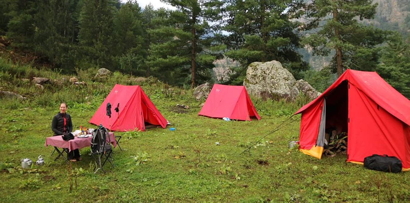
* Scenic scheduled flight to Nepalgunj and Simikot from Kathmandu
* Explore Rara National Park
* Visiting to the most wandering place
* Trekking to between Nepal and Tibet part
* Buddhism and Bonpo Tibetan culture
* Tibetan people of diverse groups and cultures
* Gateway to Manasarovar and Mount Kailash
* Rare flora and fauna
Trip Summary
| Trip Grade | Moderate to strenuous trail. |
|---|---|
| Trip Duration | 18 nights/19 days |
| Trip code | NAP-HSR- 409A |
| Trip Start/Ends | Kathmandu-Nepalgunj-Simikot/Lhasa-Kathmandu |
| Maximum Altitude | (3612m) |
| Trip Cost | Prices on request |
| Group Size | Minimum 2 upto 16 persons in one group |
| Accessibillity | Round trip to and from Nepagunj/Jumla - Kathmandu |
| The Route | Maximum altitude upto Gorosingha (3190m), 5/7-hrs average walking per day, Moderate to Strenuous trail. |
| Season | Sept – Nov in Autumn and March - April in Spring |
| Permit Fee | For the first 7 days per person US$ 50 and After 7 days per day per person US$ 7, or equivalent convertible foreign currency. |
| Trip Facilities | 3+ hotel in city on B/B and home-stay/tented accommodation onmountain. |
Itinerary

You will be met by a representative of Nepal Adventure Point and transferred to the hotel. A pre-trek briefing will be given once you arrived in the Hotel.
This morning a sightseeing tour takes in the key attractions in and around Kathmandu. We will visit Pashupatinath and Boudhanath, in the afternoon you may have time to explore Swayambhunath, and the area has an amazing range of fascinating highlights, whatever your interest. Excellent bookshops, extensive markets, and novelty and handicraft shops contrast with fantastic centers of cultural and spiritual significance - Kathmandu has more World Heritage sites than any other city in the world.
The flight from Kathmandu to Nepalgunj takes approximately 1.5 hours and is fairly dependable. During the flight we should catch a glimpse of the mountains we will be trekking among in the coming days.
Early in the morning flight to Jumla (35 minutes), Jumla airport is one of the best Nepal's remote airstrips-900m long and an easy approach- so flights operate more regularly than at places such as Lukla. This is the gateway to the wild northwest and one of the highest rice-growing areas in the world. The unique red rice is tastier than white rice but scorned by most Nepalis. Jumla Bazzar is 10 minutes more from airport and explores the Jumla Bazzar and surrounding area.
Today we start trek after having breakfast, the trail to Rara follows the north bank of Tila Khola, then turn up the other small stream. The Jumla Valley disappears behind the ridge as the trail follows the river, keeping fairly level and passing through fields and pine forests. Now trek begins an ascent up the Padmara Valley and becoming steeper as the climb continues. We have our lunch in proper place. Along the Padmara valley, the canyon becomes very narrow with vertical cliffs on both sides as the trail ascends through a deep forest of pines, spruces and firs. Finally we arrive in the last village of Padmara and we continue the trek until reaching Danphe Langa.
In the morning after breakfast, the trail descent becomes steep, through forests of firs, birches, walnuts and bamboo and some a short level stretch the trail zigzags down to the Sinja Khola, crossing it on a log bridge and follow the river downstream to Nyawre. Then we continue the serious climb, passing through marijuana fields and over a ridge into a side valley. Now the steep climbs continues for a while and the trail makes a turn into a big valley then descends until reaching Chautha.
In this day, the rocky trail follows the stream uphill, crossing it as the wooded valley becomes narrower. The climb continues to the Bhulbule where entry our permit and above Bhulbule the trail emerges into an immense treeless meadow and climbs gently but steadily to an assortment of Chhortens, cairns and prayer flags atop the Ghurchi Lagna. From here, there are views of the Mugu Karnali River and snowy peaks bordering Tibet. The route descends gently on a broad path to a hut, and then drops precipitously down a rough trail through spruces forests. Follow the direct trail to Rara Lake, which stays more or less level through pine forests, and then descend to the Jhyari Khola and another stretch of easy walking leads to Dhotu.
This day, cross s stream and make a steep climb to Thakuri Village of jhyari, in a picturesque grove of giant cedars. Then continue climbing through cedar forests to a huge meadow a top ridge with a great view of Rara Lake. Descends on the northern side of the lake where camping ground is available.
Today we are exploring the largest lake of Nepal. It is almost 13km around the lake and a day devoted to making this circuit is well spent. There is a few parks wardens’ house, and the remnants of the now-deserted villages of Rara and Chapra on the northern side of the lake, but otherwise it is an isolated region where birds, flowers and wildlife thrive. Rara is Nepal’s largest lake and is surrounded by the protected forests of Rara National Park in the Karnali district. There is an abundance of wildlife in this area including musk deer, leopard, ghoral, tahr, Himalayan black bear, and the rare red panda. The water of the lake is crystal clear and the area is a stunning place of natural beauty. We will spend a rest and acclimatisation day here. The Great Himalaya Trail has 2 options in the far west - 1) From Gamgadhi to Simikot and the Yari Valley 2) Cross country from Rara Lake to Kolti and Chainpur and on to the Mahakali Nadi (river) in India. We will travel the Gamgadhi to Simikot and Yari route, as this route travels closer to the centre of the Great Himalaya Range. There is yet to be a crossing found to the Mahakali Nadi, which is further to the west, therefore our finishing point for the GHT is currently Simikot after trekking north to Yari.
Leaving our idyllic rest stop at Rara Lake we descend to Gamgadhi, taking a left turn in the bazaar before continuing another 40 minutes to the Karnali bridge. Another 4 hours brings us to Bala and then a further 1.5 hours to Karnali. Stay overnight at tented camp.
We cross the suspension bridge from Karnali and climb a steep, rocky trail, trending left until we crest a ridge at 2180 metres. We descend to a small river and then another climb brings us through fields and pine forest to a ridge and then a traverse to Bam village. Stay overnight at tented camp.
We follow a trail which contours around hillsides until we reach a stream at Ghachaur. Here we begin a climb to the pass which should take approximately 3.5 hours, from the top it is an easy descent to a pretty campsite by a stream. There is a tea-shop close by which is 15 minutes before reaching Jogimara. Stay overnight at tented camp.
We make an easy short ascent from Jogimara to a ridge at 3120 metres before a longer descent of 500 metres to a small stream before climbing again, crossing a landslide area. From here we have views of the lower valley and the village of Rimi. We make a long traverse to Deuri, passing by a school before descending to Darma village. Continuing through the village we drop down through a series of steep switchbacks to the main trail by the riverside, and then crossing a suspension bridge over the Humla Karnali and finally a short climb to Piplan. Stay overnight at tented camp.
We continue trekking through the traditional villages of Nimagaon and Korka climbing a series of switchbacks and crossing a basin between ridges before halting at a stream for our lunch break. Climbing once again to the village of Puma we take a right fork and and ascend more switchbacks in pine forest to Apsia Lekh. Stay overnight at tented camp.
Today we have magnificent views of Saipal and surrounding valleys as we follow a contouring trail to Kallas. From here we descend to the river and then climb an easy trail to a ridge and descend once more to the Rodikot Khola. A further east climb of 1.5 hours brings us to our campsite beside the Punkha Khola. Stay overnight at tented camp.
We start with a big climb of 500 meters through steep switchbacks to a kharka at 3512 meters. From here we continue climbing, gaining views north to Simikot and also to the south. We climb to over 4000 meters today before a very steep descent to the Yanchu Khola. We have a few camping options today, and there will more than likely be some livestock grazing in the valley. Stay overnight at tented camp.
Depending on weather conditions today may be a very warm day as there is little shade along the trail. We descend for 15 minutes or so alongside the river before an easy gradient climb to Durpa village and a further descent to the pilgrimage site of Kharpunath. Continuing on another 30 minutes we turn into the Kudila Kola valley, from here we ascend to some teashops and cross a metal bridge before the final set of switchbacks which lead us to Simikot. Stay overnight at tented camp.
This morning we fly to Nepalgunj and to Kathmandu, a thrilling flight over forests, fields and villages, with the Himalaya in the background. On arrival, we transfer to the hotel. The rest of the day is at leisure.
Note: Travellers those who have longer holiday on returning from Simikot there is the possibility to visit the Bardia Nationalpark.
After breakfast arrangements cease unless further ones have been made. Those people departing by aircraft will be transferred to the airport and assisted with check-in procedures.
Cost Included
* Documents: All necessary paper work and permits (Rara /National Park entrance permits , Simikot and Rara Lake special perrmit and TIM’s card).
* Land transportation: All airport arrival and departures transfer and touring as per the itinerary by private vehicle
* Activities: Sightseeing, flying, hiking and trekking as per the itinerary.
* Accommodation: 3 night hotel in Kathmandu, 1 night hotel in Nepalgunj on twin sharing and 14 night’s home-stay/ camping accomodation in mountain on twin sharing or multi – share bedroom.
* Food: 3 meals a day providing from teahouse/camping (Breakfast, Lunch and Dinner) during you’re staying in mountain.
* Staffs: Leader/Guide and supporters and their daily wage, food, and accommodation
* Company and Government’s service charge: All applicable Government taxes and official service charges. And Crew’s, daily wages/salary, food, equipment and road transportation
Cost Excluded
* Kathmandu to Nepalgunja-Simikot and return flight to Kathmandu
* Travel/medical insurance coverage personal accidents, medical and emergency Helicopter rescue
* Personal travel and trekking equipments
* Lunch and dinner while in city
* Items of a personal nature such as normal drinks, hot shower, dessert, laundry, internet and phone call.
* Expenses occurred due to unavoidable Events i.e. road wrecks, flight delays etc.
*Temple and monastery entrance fees
* Tips/Gratuities for trekking crews
* Optional activities
* Unforeseen expenses which are out of control by Nepal Adventure Point
Trip Notes
Please request our Trip Note advice and detailed itinerary.